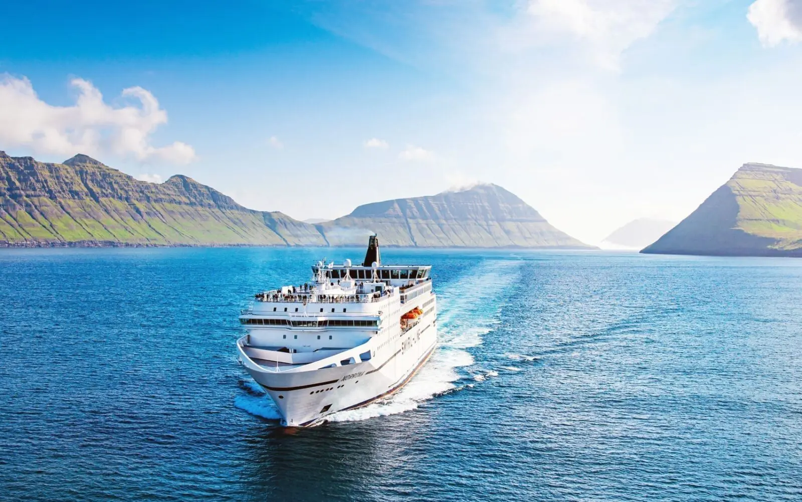
Highlights of Iceland
The Land of Fire, Ice & Natural Wonders
Are you looking for an authentic nature experience in Iceland?
We have a wealth of ideas for authentic Icelandic nature experience in places where hospitable locals would be proud to show you their country.
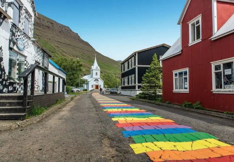
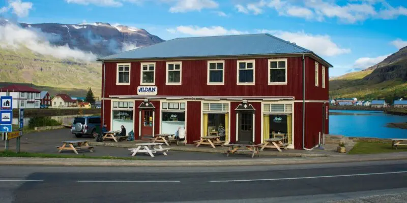
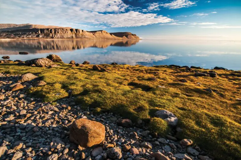
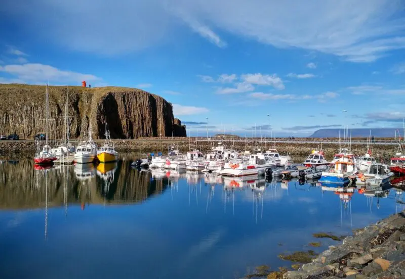
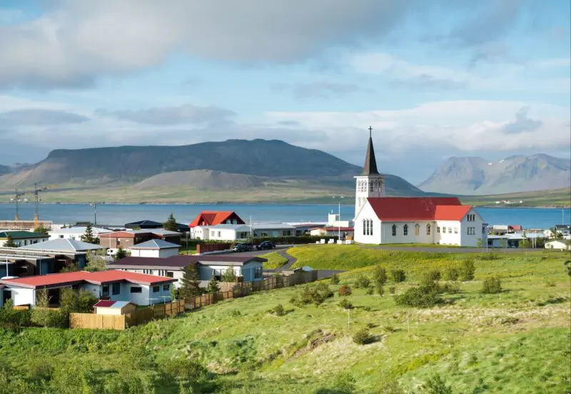
A Historic Town in the Eastfjords
East Iceland boasts spectacular mountain views and beautiful fjords. Seyðisfjörður is one of these fjords and on its shores a historic town by the same name is nestled.
Read more
Seyðisfjörður is where our travellers get to experience rural Iceland first hand, enjoying spectacular landscapes and the lively atmosphere of a small town.
A Town Steeped in History
The history of the town dates back to the year 1848, when Norwegian Fishermen first settled there. Over time it has become one of the largest fishing ports in Iceland. The Norwegian fishermen built colourful wooden houses, which are still dotted around town.
Culture and the LUNGA Art Festival
Seyðisfjörður town has a rich cultural life and is the scenic setting for the art festival LUNGA, where art and music come alive every July. On arrival in Iceland why not make the most of the fresh mountain air and stroll over to see the Blue Church with all its history, you can walk along the rainbow path on your way to it.
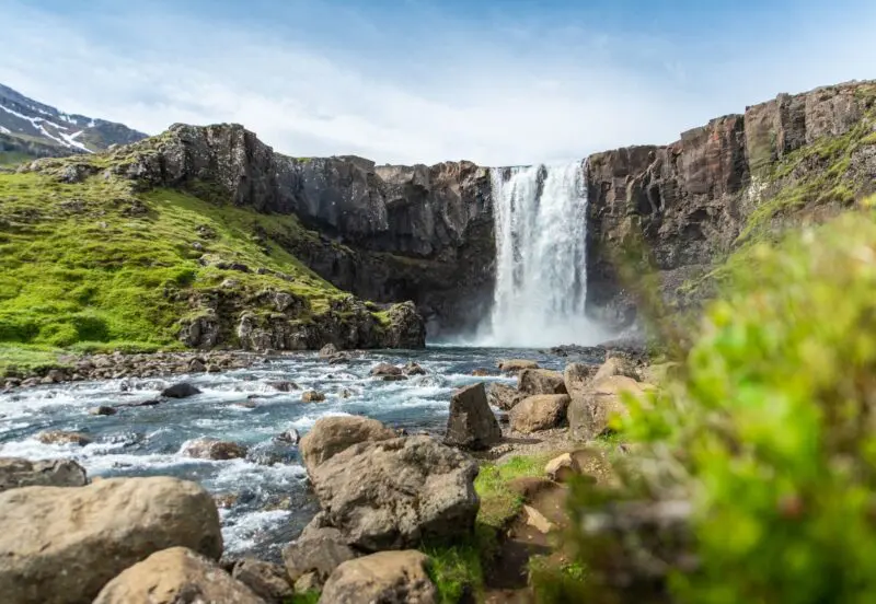
On the Road from Seyðisfjörður
When you leave Seyðisfjörður, you drive across the mountain heath of Fagradalsheiði. There you can stop at Gufufoss, Steam Waterfall in English, and enjoy the sight of the tumbling waters and the majestic view of Seyðisfjörður from above.
It is a beautiful way to start your adventure in Iceland. Read more about Seyðisfjörður and what to do here.
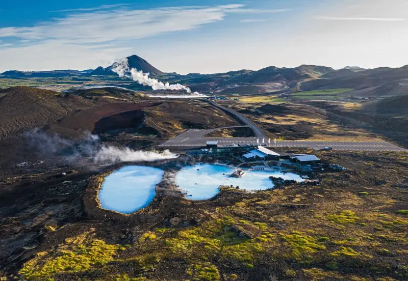
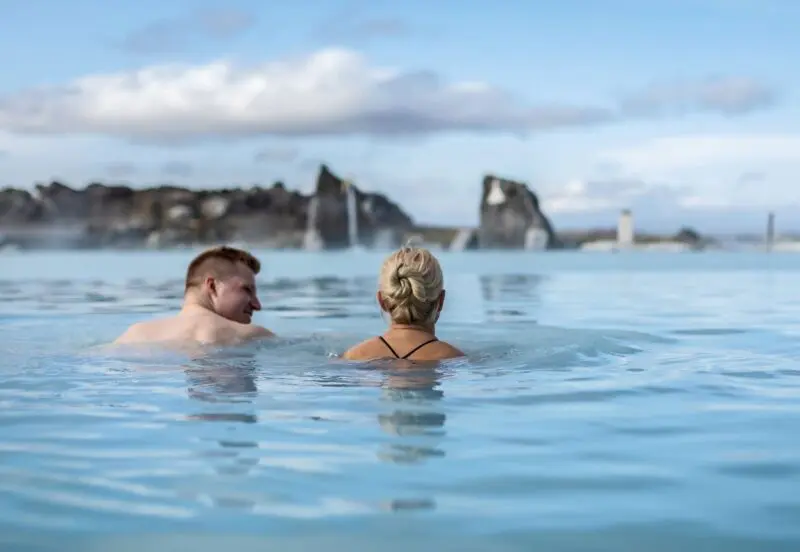
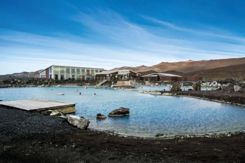
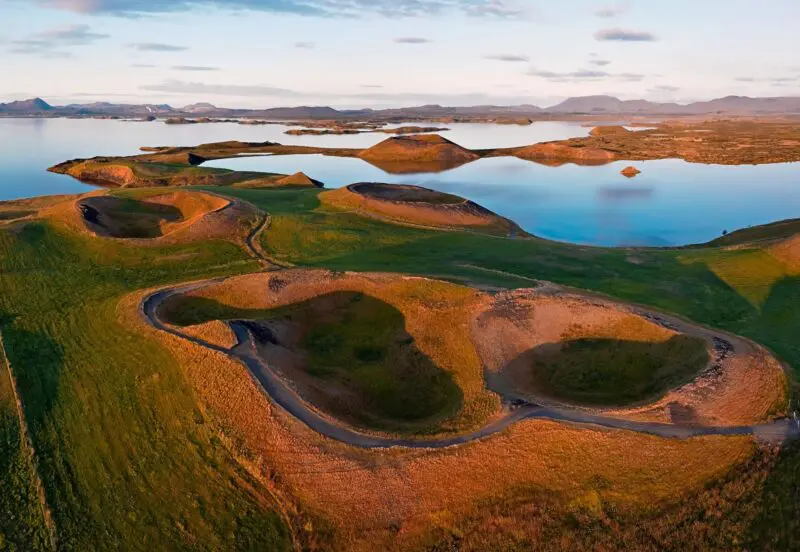
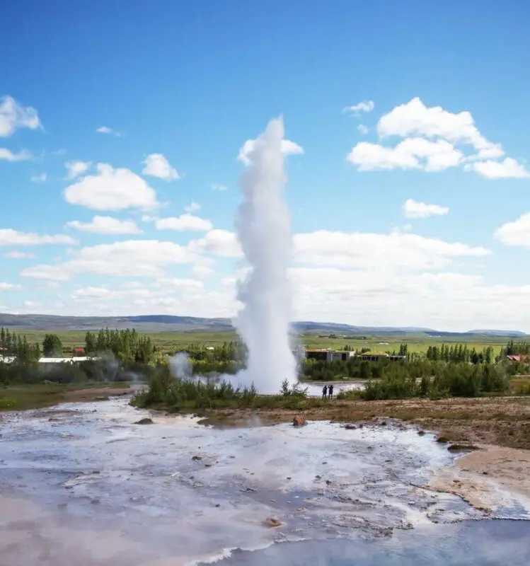
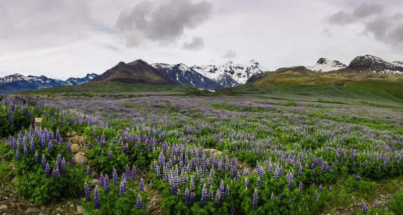
Mývatn, Námaskarð & Dettifoss
Lake Mývatn is one of the highlights of North Iceland. It is rich in bird life and Sigurgeir’s Bird Museum is well worth a visit. Mývatn Nature Bath lies east of the village Reykjahlíð. Here you can enjoy a relaxing dip in the naturally warm water.
Read more
Tip: Mývatn Nature Bath is often called ‘Mini Blue Lagoon’. If you are looking for an authentic bathing experience at a reasonable price, we recommend a visit to Mývatn Nature Bath where you will not have to queue.
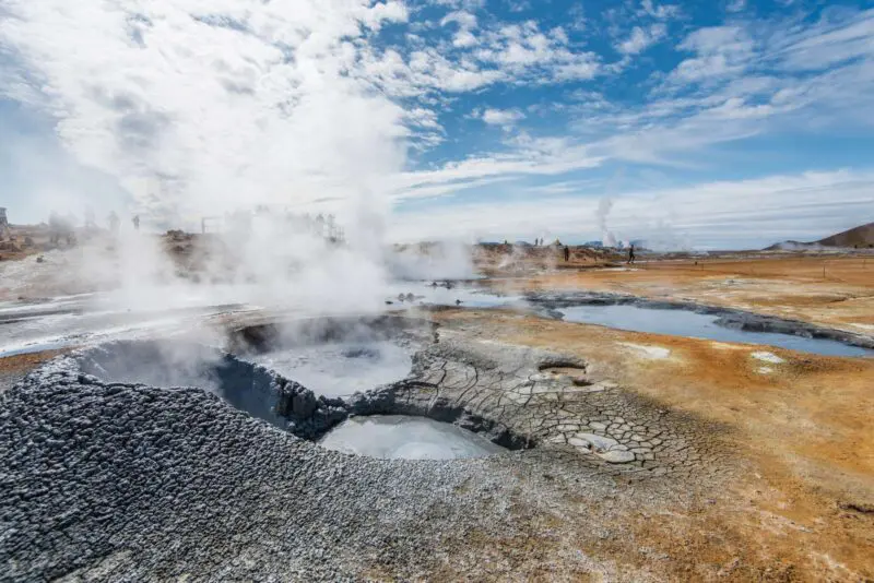
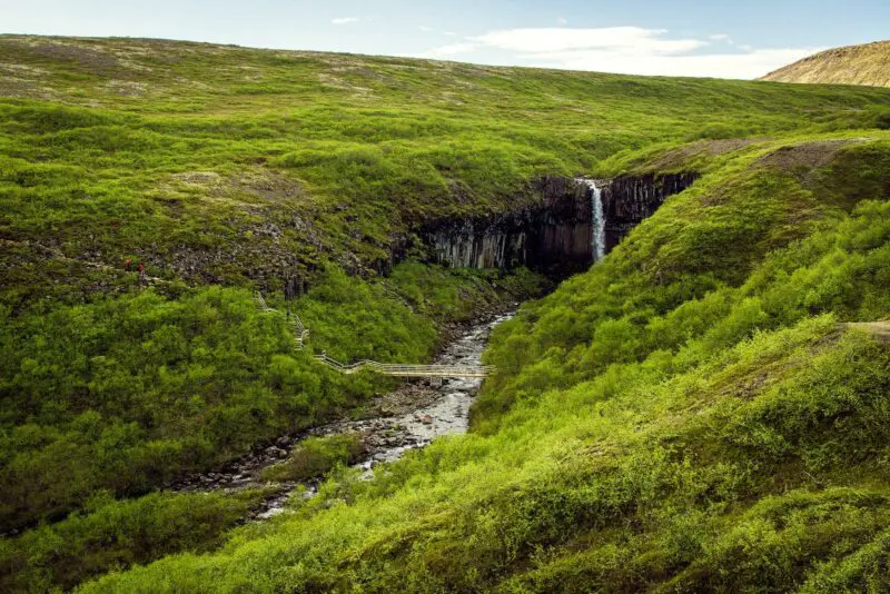
At Námaskarð you can experience the power of nature first hand. The boiling mud pits and yellow sulphur formations are an unforgettable sight.
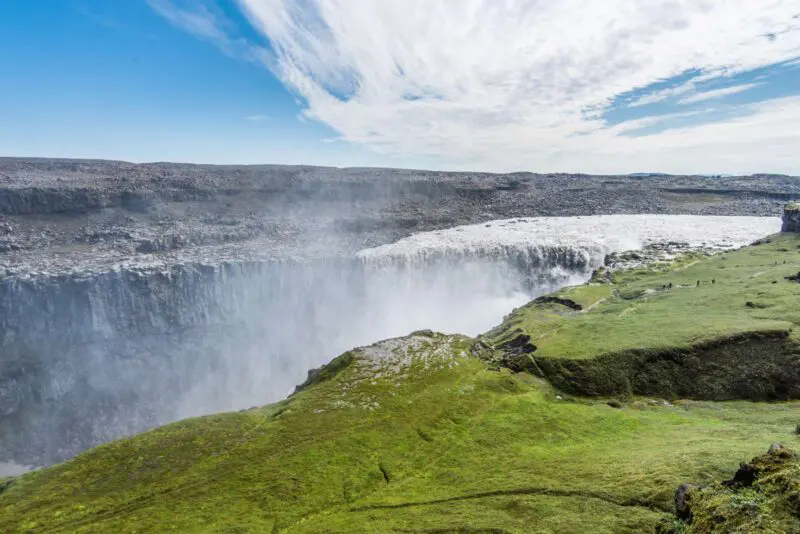
Don’t miss out on the waterfall Dettifoss, which is only half an hour away from Mývatn. With a height of 44 m and span of 110m, Dettifoss has the greatest volume of water of any waterfall in Europe.
Links
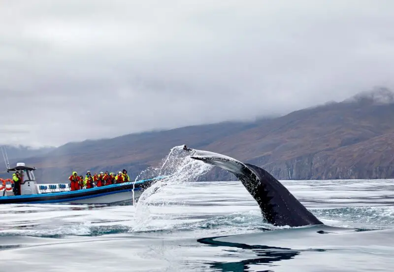
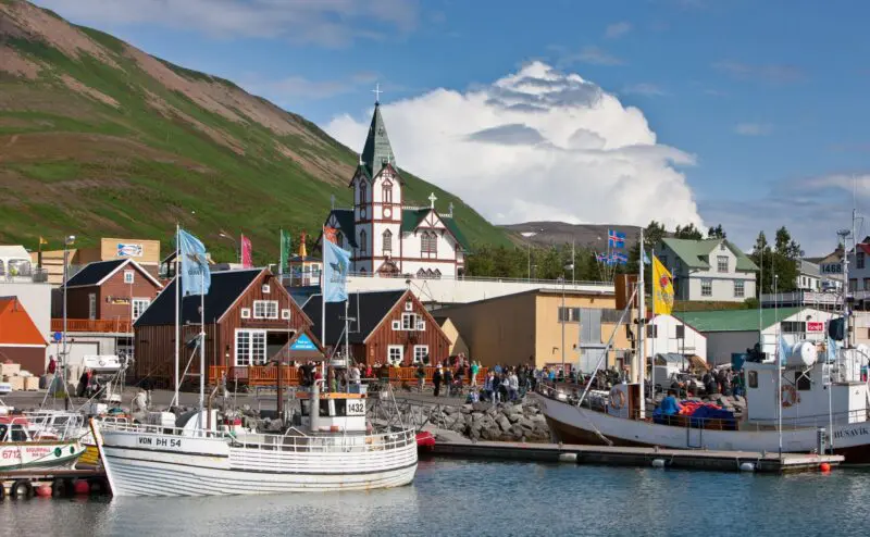
Húsavík
Gain insight into the life of the imposing and majestic whales in the sea around Iceland with a trip to Húsavík. Visit the whale museum and go on a whale safari for an opportunity to experience the whales and many ocean birds up close. It is a chance to experience local wildlife in its natural habitat.
Read more
If you have more time to spend in Húsavík, why not try the new GeoSea sea baths? It is a rejuvenating experience for the body and soul while enjoying nature in a unique manner.
The Goðafoss waterfall is one of the most spectacular waterfalls in Iceland. The Goðafoss waterfall is situated a 30 minutes drive east of Akureyri and well worth a stop.
Links
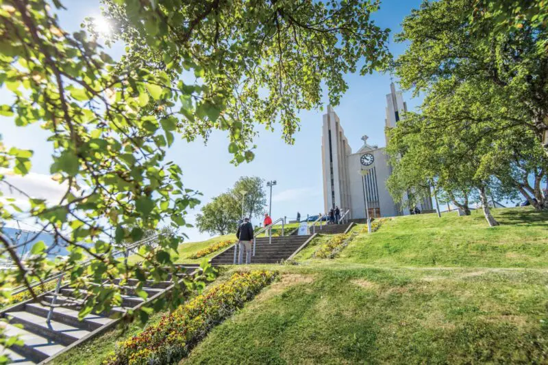
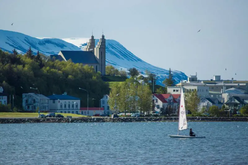
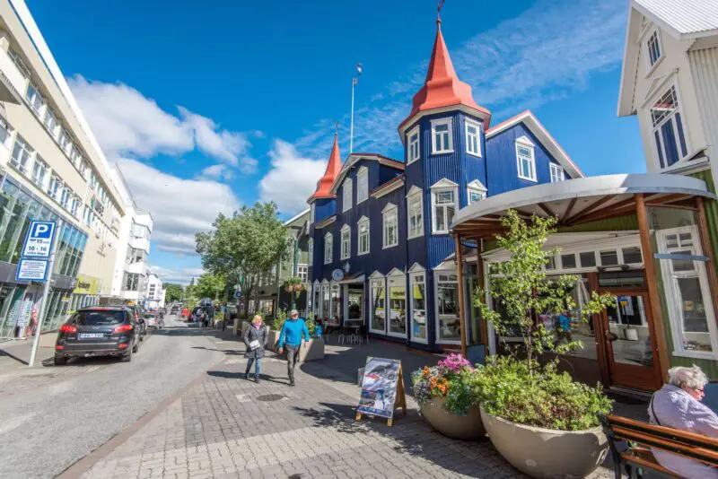
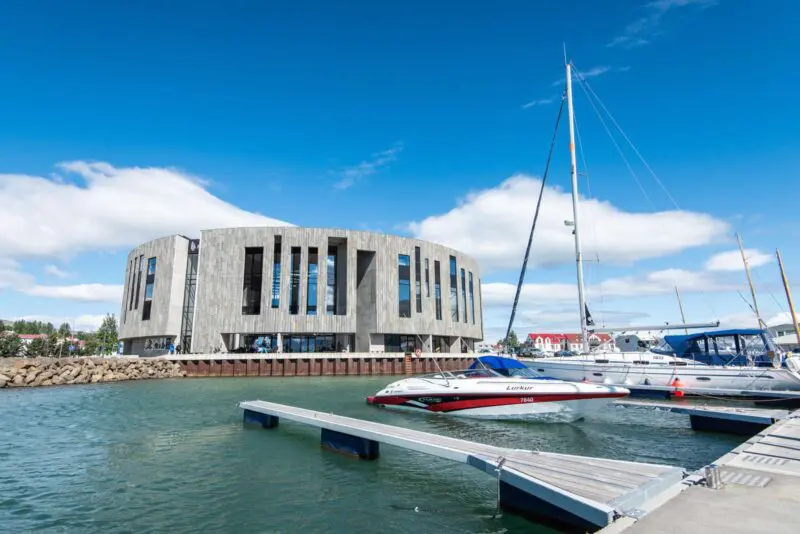
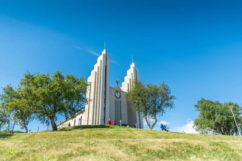
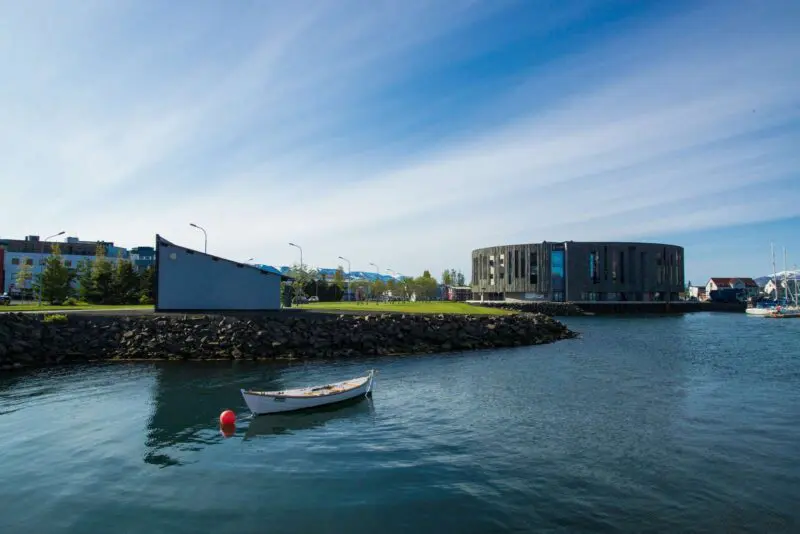
Akureyri
Visit Iceland’s second largest city Akureyri just south of the Polar Circle. In Akureyri you will find the towering Church of Akureyri in pure art-deco style from 1940. It was designed by the Icelandic architect Guðjon Samuelson.
Read more
With around 17,000 inhabitants the city is, understandably, easy to navigate. It only has one shopping street, but compensates with myriad little side streets with quirky cafés and restaurants.
Links
Westfjords
Are you ready for an insider tip? The Westfjords Region is one of Iceland’s best-kept secrets. Each fjord is a world in itself and every mountain competes for your attention. Even the least remarkable parts of Westfjords radiatenatural beauty and are almost impossible not to explore.
Read more
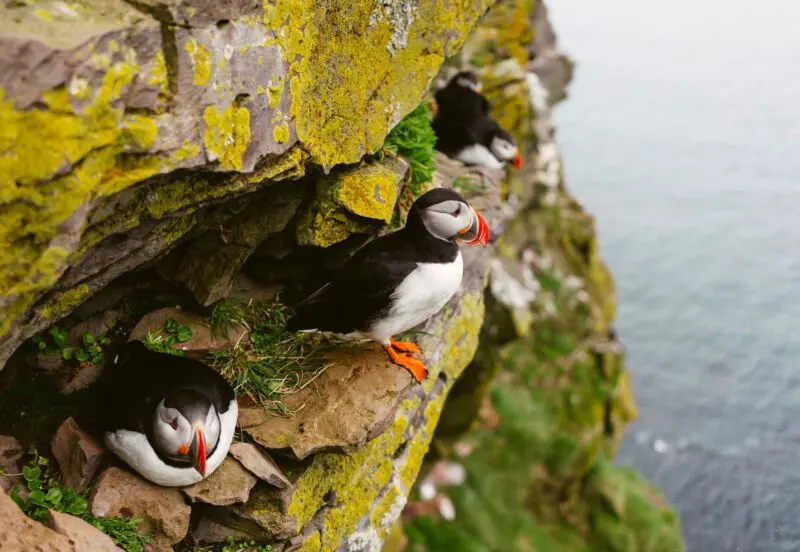
Westfjords Region is home to Látrabjarg, the westernmost point in Europe and one of Europes biggest bird cliffs.
Links
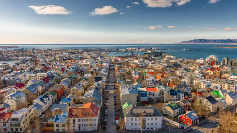
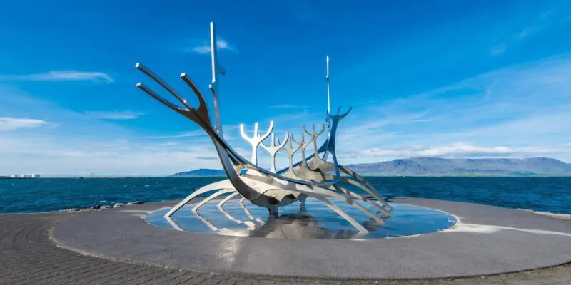
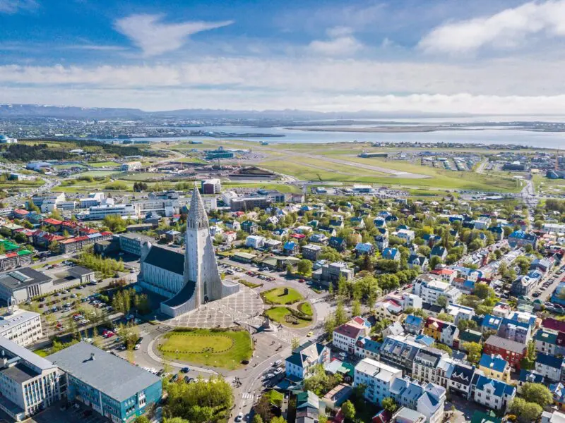
Reykjavík
Settled in 870 AD by Ingolfur Arnarson, the capital of Iceland, Reykjavík, is located on the west coast. Lore has it that early settlers brought their family’s high seat pillars, wooden poles flanking the seat of the head of a Norse household, when they migrated to Iceland. According to legend, on arrival Ingolfur Arnarson cast his high seat pillars overboard and settled where they washed ashore in today’s Reykjavík.
Read more
With its rich Norse history, the capital has grown into a fascinating hub of culture, events and historic buildings. Reykjavík is the largest, and arguably only, city in Iceland, around 36% of the population lives in the capital area. It is surrounded by picturesque towns where travellers can hike in high mountains and experience the countryside only 20 minutes from the metropolis.
Festivals and Cultural Life
The city is known for its cultural scene that brings locals together to celebrate diversity and culture. August brings LGBTQ+ Pride, a true family celebration and the biggest in the world by percentage of national population participating, as well as Reykjavík Culture Night. One feature of the Culture Night is the Reykjavík Marathon, the only one held in Iceland.
A Taste of Reykjavík
With its deeply rooted traditions, the Icelandic restaurant scene is something to sample. From fine dining to the famous local hot dog stand, ‘Bæjarins Bestu’, travellers will always find something to feast on. In fact, Reykjavík has no fewer than 5 food halls, 4 located within 15 minutes walking distance of each other! No need to go hungry.
Architecture Old and New
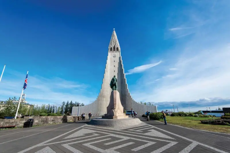
They city is also a treasure trove of historic and contemporary architecture. The most famous is perhaps Hallgrimskirkja Church, the tallest building in Iceland, visible all the way from Mount Esja. Another important building is the Parliament Hall, Althingi, at Austurvöllur, which is a lovely area for travellers and locals to enjoy the day surrounded by restaurants. One unmissable contemporary building is the Harpa Concert Hall. Built during and in spite of the economic crisis, the concert hall is testament to how important the arts are in overcoming adversity and the aspirations of the Icelandic people.
A City Like No Other
In short, in Reykjavík you will find everything that makes a city, except skyscrapers, which most travellers would probably say is an added bonus.
Read all about Reykjavík here: VisitReykjavik.is
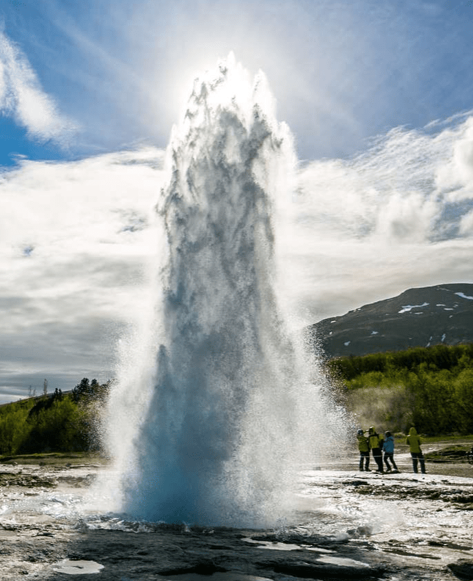
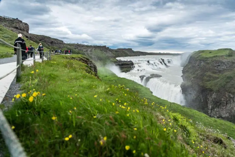
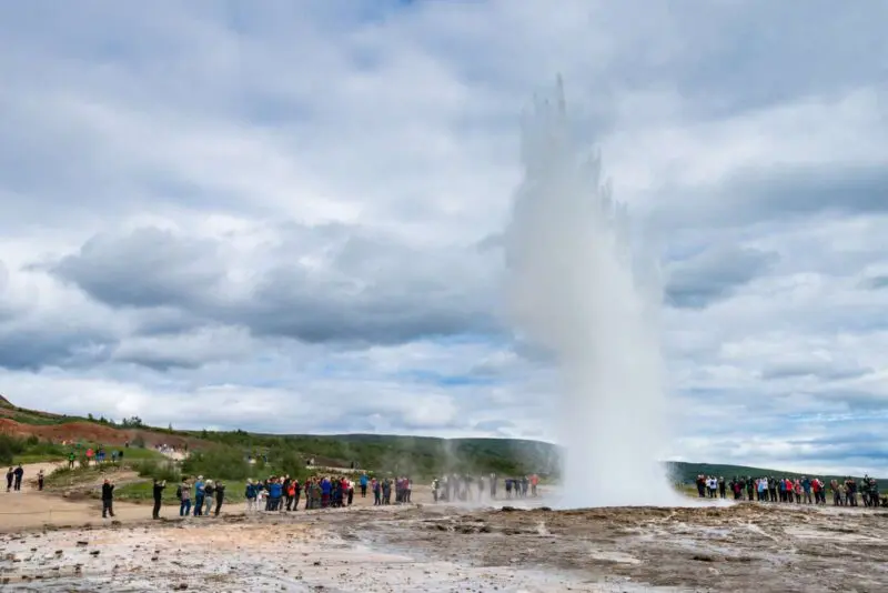
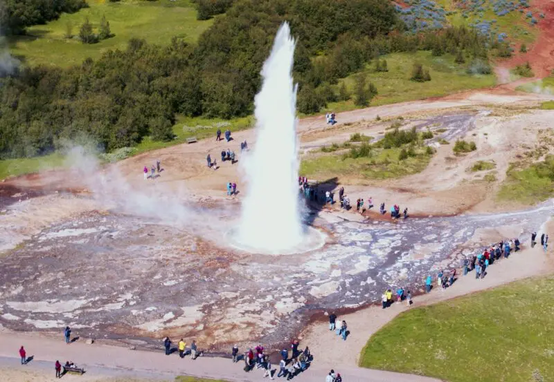
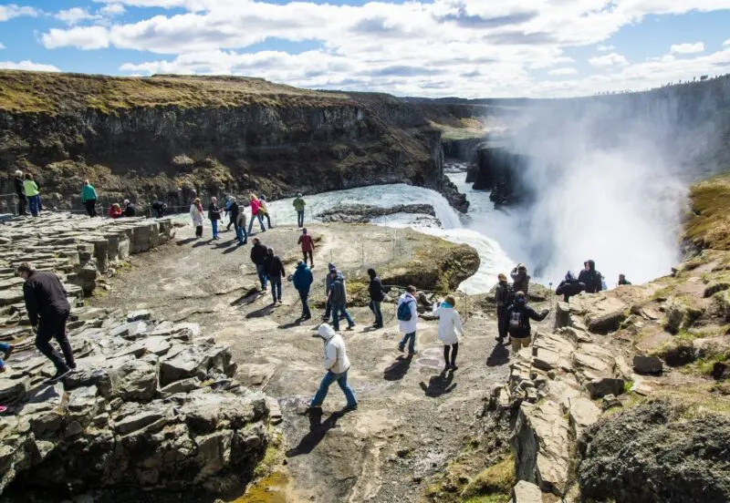
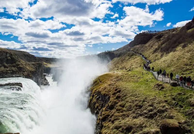
Golden Circle
The Golden Circle is Iceland’s most popular tourist route. The 300 km round trip sets off from the capital Reykjavík to southern Iceland and back again. There are three main stops on the way: þingvellir National Park, the Gullfoss waterfall and the geothermal area Haukadalur, which is best known for the geysers Geysir and Strokkur.
Read more
Reykjavík is Iceland’s capital and largest city. It covers 274 km2 and has around 200,000 inhabitants. There is much to see and do in Reykjavík. We would particularly highlight Hallgríms Church, Harpa Concert Hall and Laugardalslaug outdoor pool and spa.

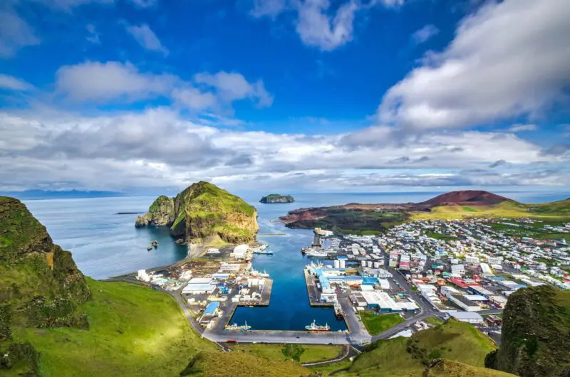
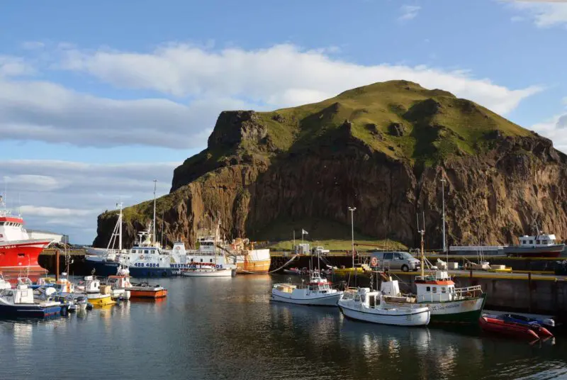
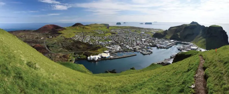
Vestmannaeyjar
Vestmannaeyjar is an archipelago of volcanic origin just south of Iceland. It is made up of 14 islands of which only one, Heimaey, is inhabited. It has around 4,000 residents. The area is, like the rest of Iceland, a land of active volcanoes.
Read more
In the 20th century the islanders experienced two major eruptions. The first was in 1963 when a 3½-year-long eruption created the island Surtsey. The other was when the volcano Eldfell on Heimaey erupted in 1973. It led to the rapid evacuation of most of the island’s inhabitants. Travel here to experience bird-life and nature unlike anywhere else in Iceland.
Links
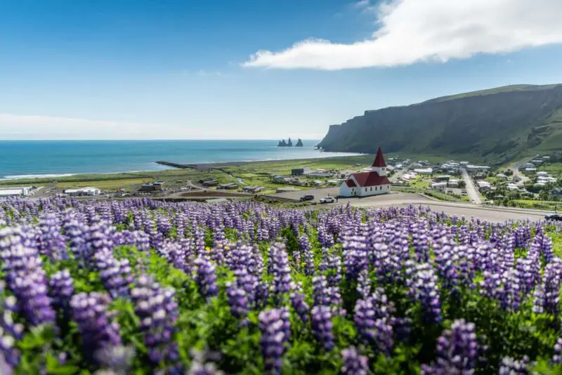
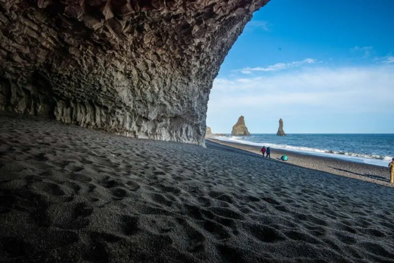
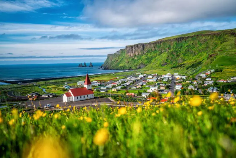
Vík
The village Vík is the southern most village in Iceland, it is on the Ring Road around 180 km from Reykjavík, approximately 2-hour drive. Iceland has several volcanic beaches; however, Reynisfjara Black Sand Beach is by far the most striking and famous. It is easily accessible from the main road, which runs through Vík in Mýrdal and a walk along the Black Sand Beach is a must.
Links
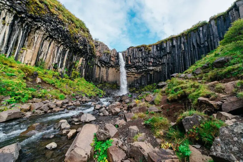
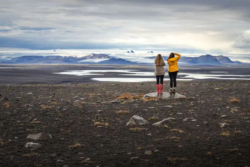
Skaftafell National Park
Skaftafell National Park was founded in 1967; however, in 2008, it became part of the larger Vatnajökull National Park. Combined they cover roughly 14,200 km2 making them Europe’s second largest national park.
Skaftafell National Park lies at the foothills of Iceland’s second-largest glacier Vatnajökull, which covers an area of 8,100 km2 and is 1 km deep in places. We recommend the 1-hour walk to the stunning waterfall Svartifoss.
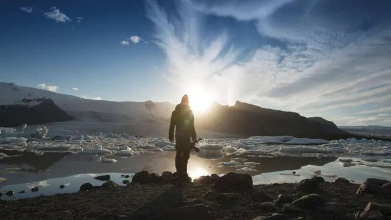
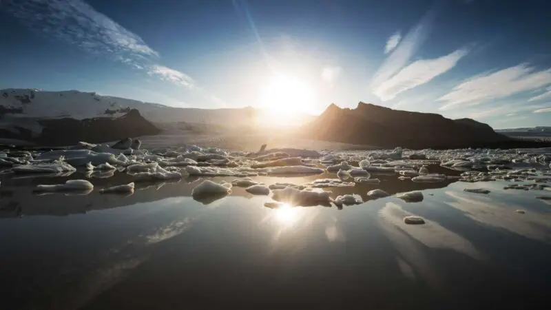
Jökulsárlón
In the south east corner right below Öræfajökull, which is the southernmost and highest area of Vatnajökull there is a lake right below the glacier by Jökulsá River at Breiðamerkursandur. The river runs the short stretch from the glacier into the Atlantic Ocean.
Read more
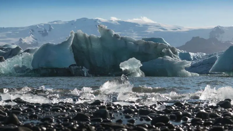
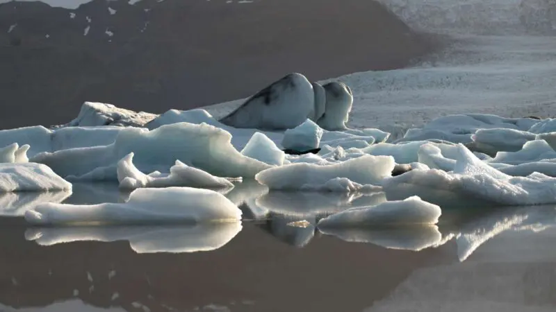
Icebergs, blue, white, blue green and striped, float here in a continuous ice dance. The ancient icebergs are calved by the ever-receding Öræfajökull.
Depth and Drama
The water rises and falls with the weather. At present it is one and a half kilometres from the sea. The area is about 18 square km. It was recently measures as one of the deepest lakes in Iceland – over 248 m.
A Famous Filming Location
Jökulsárlón is part of Vatnajökull National Park. It forms an enigmatic backdrop in several films and television series, such as Batman Begins, two James Bond movies and Game of Thrones.
Wildlife and Activities
Jökulsárlón faces the sea and its unique mixture of fresh and seawater is what creates its rare blue green hue. In summer you can sail on Jökulsárlón with a boat. Walking around the lake is also possible all year round. Seals inhabit the icebergs in winter and the water is teeming with fish and visited by myriad bird species.
Winter Magic
Journeying to Jökulsárlón to see the northern lights is a popular winter pursuit.
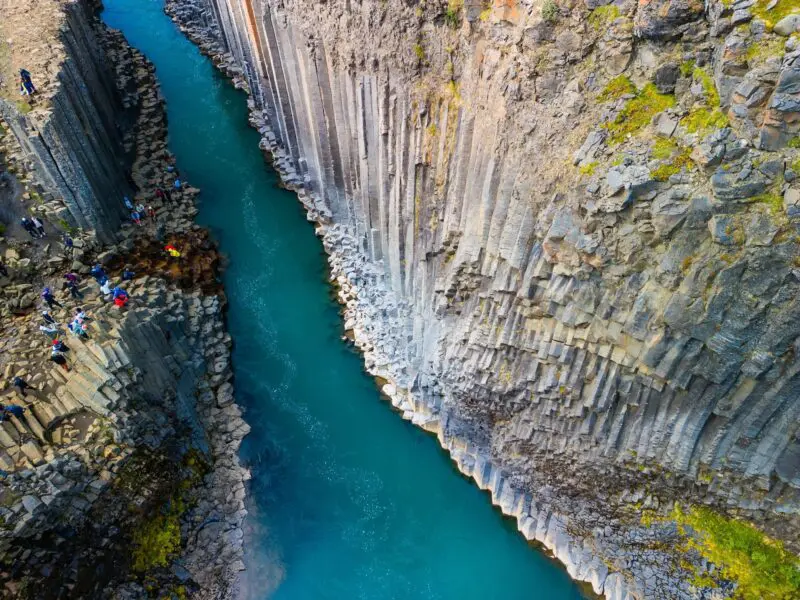
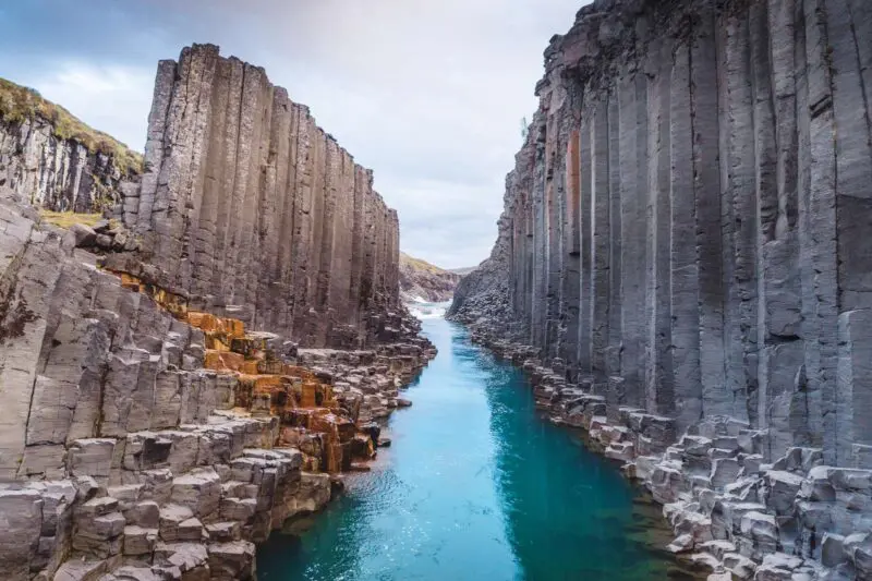
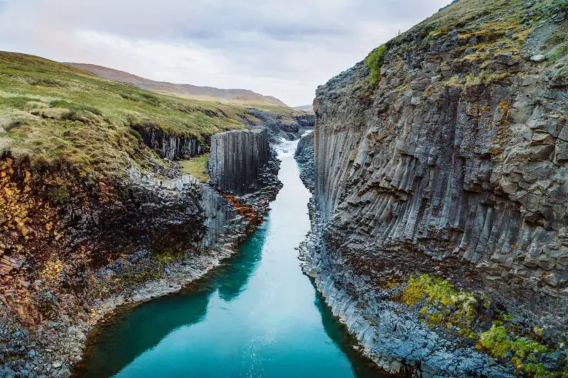
Stuðlagil
Stuðlagil Canyon is located near Ovari Jökuldalur in Fljótsdalur in East Iceland. The place is a marvel of nature. The canyon was uncovered after the large Kárahnjúkar Hydro Power Plant started operating. The creation of the Hálslón reservoir drastically reduced the volume in the fierce Jökulsá á Dal River, known as Jökla.
Read more
Jökla is the longest glacier river in Iceland. It flows approximately 150 km from Vatnajökull out to sea in East Iceland.
Stuðlagil is one of the largest basalt column areas. When water levels are high, the river acquires a blue green hue, but when it flows across the dam it turns grey-brown.
Getting There
It takes about one hour to drive from Egilsstaðir to Stuðlagil. From Mývatn the trip takes about one and a half hours. Travellers must veer off the Ring Road along a gravel track. The stretch is passable for all ordinary cars, though you may need a sturdier vehicle on a winter’s day.
Two Routes to the Canyon
Route one
Turn south off the main road, road number 1, across Jökuldalur over to road number 923. From there you are 19 km away from the Grund Farm, which is north of the canyon. Here there are parking lots, toilets and access to the canyon via stairs.
It takes five minutes to walk down to the viewing platform. A variety of basalt column formations are visible from there. In order to continue down into the canyon, you have to walk from the parking area south of the canyon.
Route two
Turn south off the Ring Road, road number 1, across Jökuldalur over to road number 923.
Then drive towards Klaustursel Farm, here you can park either at the bridge across Jökla, from where the walk down to the viewing platform and back is about 10 km, or by Stuðlafoss, where the total stretch is 5 km.
Walking down into the canyon to observe the majestic Stuðlafoss, which tumbles down knife-sharp basalt columns is well worth the walk. Please take extra care to mind the environment in the period from May 1st to June 10th, because at that time pink-footed geese are nesting in the area. You should always, and especially during this period, stick to the path!
Driving in Summer
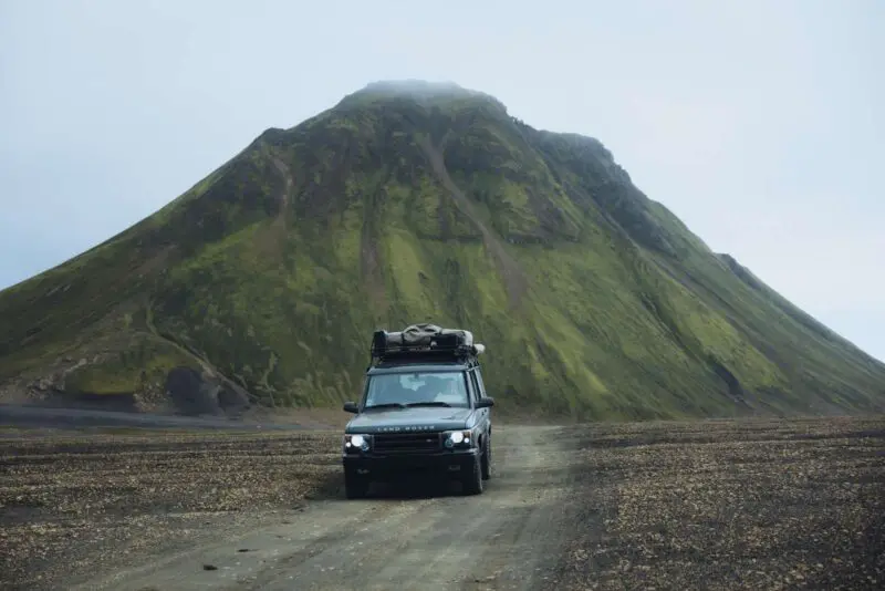
In summer you can drive an ordinary vehicle along road 923 into the highlands to the east and to Kárahnjúka, Laugafell and down into Fljótsdal along another road, which is only suitable for four-wheel drive vehicles.
More detailed information is available on the Stuðlagil website.
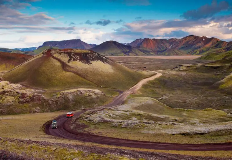
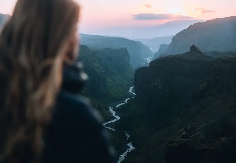
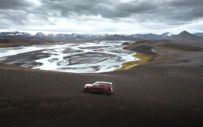
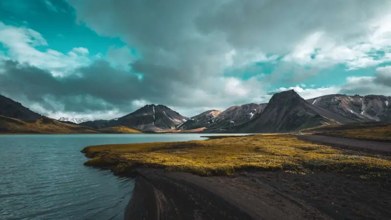
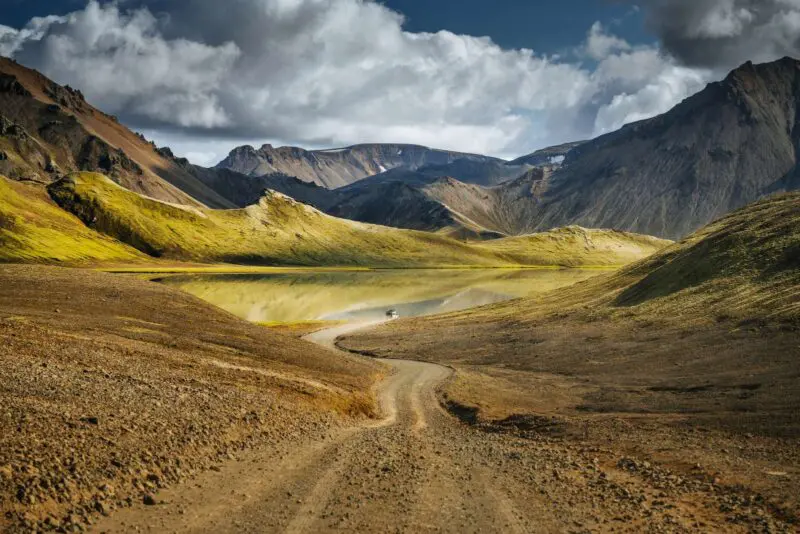
Highlands
The Icelanders call the desert and mountains in the middle of the country Miðhálendið, the Central Highland. Silence and tranquillity reign here. The Central Highland is expansive and stretches to most of the country. There are great riches to be found here far from the maddening crowds and bustling cities!
Read more
Hvannadalsknúkur and Bárðarbunga
The Central Highland is completely barren and located more than 500 metres above sea level. Several of the summits are snow-clad glaciers. Among them towers Iceland’s highest mountain, Hvannadalsknúkur, at 2.109 m above sea level. The mountain is just south of Vatnajökull. You can ride a helicopter to the top!
Another summit is Bárðarbunga, a snow-clad volcano in the northwest corner of Vatnajökull.
The barren Central Highland covers most of Iceland’s main island. This volcanically active area is diverse with its volcanoes, stony ground, rock formations, sand expanse, glaciers, rivers, lakes and vegetated oases.
The area is first and foremost a mix of national land, owned by the state, and high mountain fields, which are used for grazing.
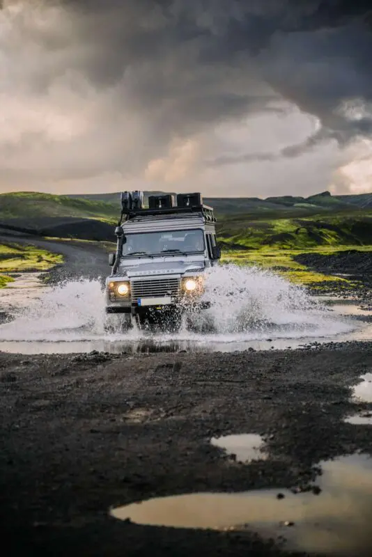
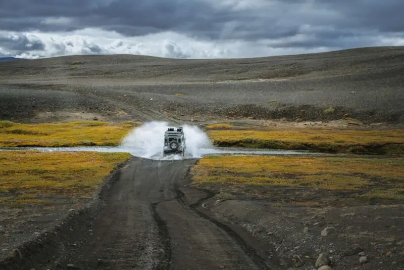
Mountain Roads
In the past the roads connecting the various corners of the country all ran through Iceland’s Central Highland, to this day some of these mountain routes remain in use, such as Kjölur, Kaldidalur and Sprengisandur. Five of the highest mountain roads in Iceland are located in the Central Highland.
Vatnajökull National Park encompasses most of the southeast region of the highland. Vatnajökull itself is the largest highland glacier. It is followed by Hofsjökull, which is nearly the centre of the country, and the neighbouring glacier, Langjökull.
You can drive between the glaciers. The roads are usually opened in June or July.
Kjölur is a gravel road on the highland plateau with mountains and hot springs. In mid summer this gravel road connects South Iceland and North Iceland. The road is located between Hofsjökull and Langjökull and runs close to rhyolite mountains and hot springs.
Another route, Sprengisandur, crosses the highland further east. Here you can drive along another gravel path between Hofsjökull and Vatnajökull. Preferably by jeep, because you will need to ford rivers.
Kaldidalur is also a magnificent highland path, which runs west of Langjökull. From there the route continues down to Thingvellir and Borgarfjörður.
Please note, it is strictly prohibited and a criminal offense to drive off-road, all drivers must stick to the official marked roads or paths. It is also very crucial to ask ahead about everything, because both bogs and peat heaths in Iceland are sensitive natural areas.
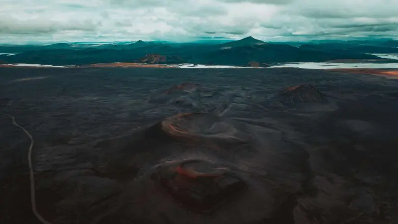
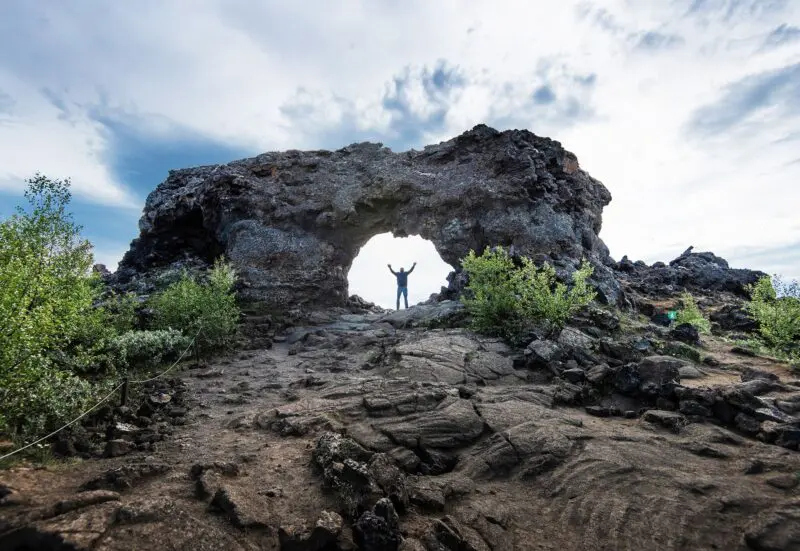
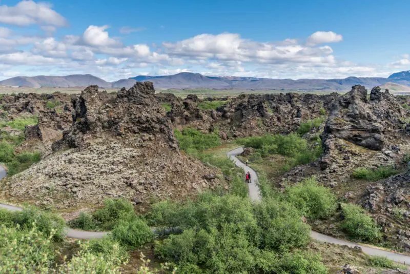
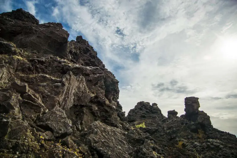
Dimmuborgir
Lava bubbled and steamed when Dimmuborgir was born in a volcanic eruption in Lúdentsborgir and Þrengslaborgir about 2,000 years ago. Indeed, it was the largest volcanic agglomerate eruption Mývatn has experienced since the ice age.
Dimmuborgir are located in a small valley. According to experts, when they were formed, the molten agglomerates flowed into the depression, gradually filled it, and became volcanic rock. What we are left with today is the unique landscape we know as Dimmuborgir.
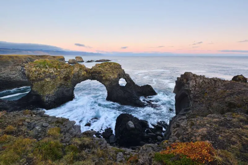
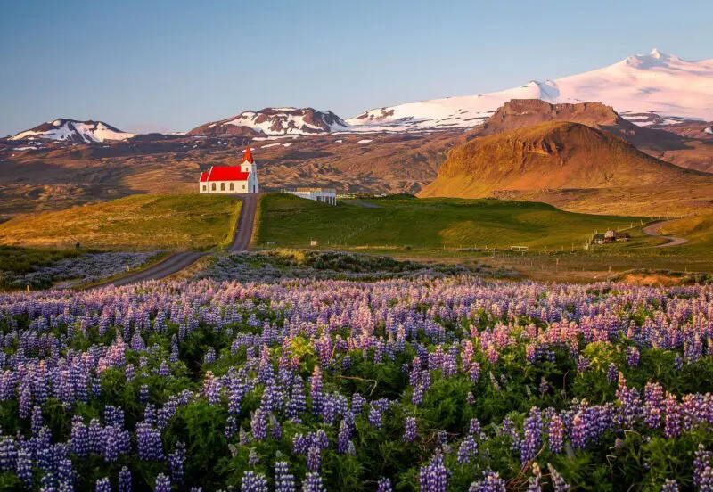
Snæfellsnes
Snæfellsnes is a long peninsula in West Iceland between Faxaflói to the south and Breiðafjörður to the north. A mountain ridge stretches along the peninsula. Highest is the 1,446 m high conical volcano Snæfellsjökull.
Read more
The northern tip of the peninsula is home to the fishing villages Stykkishólmur, Grundarfjörður, Ólafsvík, Ríf and Hellissandur. To the south there are two villages Arnarstapi and Hellnar. And to the west lie the remains of the villages Dritvík and Beruvík that were abandoned decades ago.
Stretching 90 km in length, Snæfellsnes lies right in the middle between Reykjanes and the West Fjords. Along its mountain ridge, you’ll find both active and dormant volcanoes. In fact, Snæfellsjökull, located at the very tip of the peninsula, is also a volcano.
Read on about six selected locations near Snæfellsnes:
Eldborg
On the south side you first reach Eldborg, beautiful little volcano where hundreds of aphyric basalt columns rise from the landscape. Further out on the peninsula the sands of Ytri Tunga beach are home to large seal colonies.
Rauðfeldsgjá
Afterward, you reach the stunning Rauðfellgjá gorge with its magnificent cliffs. You can walk into the gorge and, if you dare, jump into the currents!
After Rauðfeldsgjá you reach the Lóndrangar basalt pinnacles, which are the remains of a volcanic vent. Thousands of marine birds nest there.
Snæfellsjökull National Park
Then head on to Snæfellsjökull National Park, the smallest of the three national parks in the country. There is plenty to see and experience here.
The best known area is Djúpalónssandur with its dark volcanic matter. It is most famous for the four boulders people have competed to lift over the centuries. Seafarers used the boulders to display strength and toughen up for life at sea.
Additionally, the National Park features two eruptive rock caves, which are accessible in summer. Songhelli is named for its echo. The other cave, Vatnshellið, is easily accessible and colourful. Visitors are charged a small fee. There is no access without a travel guide.
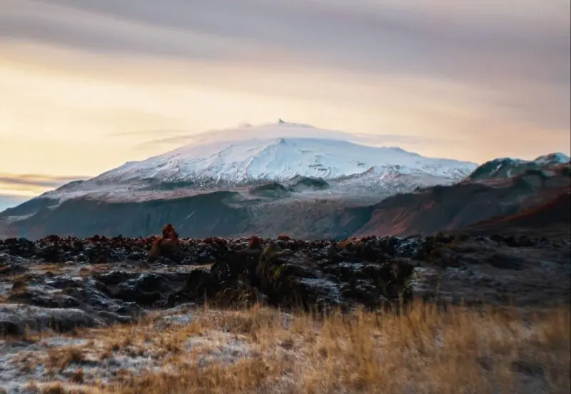
Snæfellsjökull
The highlight is without a doubt Snæfellsjökull. The adventures in Jules Verne’s ‘A Journey to the Centre of the Earth’ start here. It is often reread in the lesser known book ‘Under the Glacier’ published by Nobel prize winner Halldór Laxness in 1968.
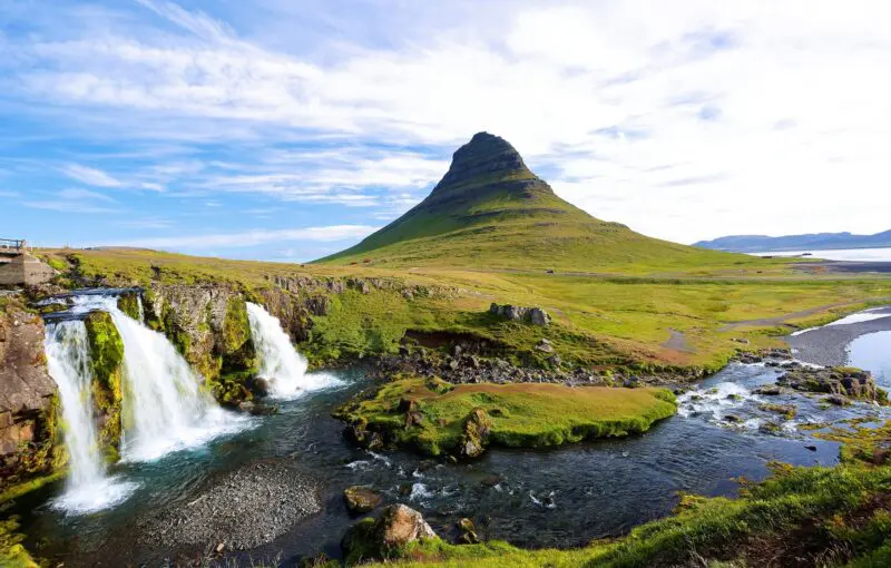
Berserkjareyn
To the north on the peninsula is Berserkjahreyn, a lava field near Bjarnarhöfn. The most remarkable part is the mountain, Kirkjufell. It is often said to be the most photographed mountain in Iceland. It is the arrow-shaped mountain in the hit HBO TV series Game of Thrones.
Traditional villages
There are also several picturesque villages in Snæfellsnes. Most are located to the north. These are great places for fishing. The villages are: Arnarstapi, Hellnar, Búðir, Hellissandur, Ólafsvík, Grundarfjörður and Stykkishólmur
Stykkishólmur is popular for its volcanic museum. In addition, visitors can catch the ferry Baldur here to visit Flatey Island, which has deep roots in history.
Other notable village museums are located in Ólafsvík.
Last, but not least, we should mention the hákall museum in Bjarnarhöfn. Here you can sample the Icelandic delicatessen well fermented Greenland shark.
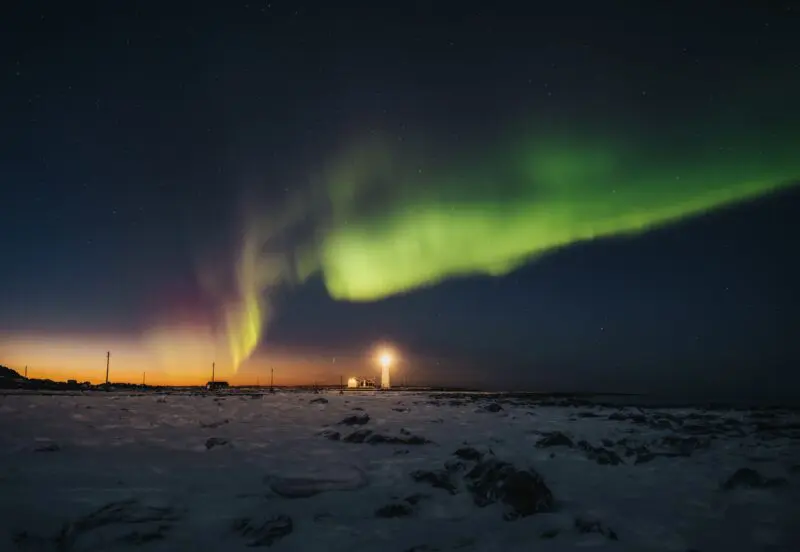
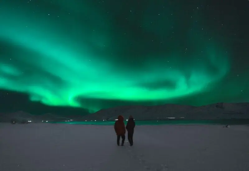
Experience the Northern Lights in Iceland
As night falls from late August to April, you have the chance to see the northern lights dance across the Icelandic sky in shades of green, purple, and red. It is one of the most memorable experiences you can have on your journey and a wonderful reason to travel outside the summer season.
Read more
The northern lights can appear almost anywhere, whether you are staying in a village, driving along the ring road or stepping outside on a clear night. For the best view, leave the city lights behind and watch the sky come alive over Iceland’s dramatic landscapes.
Furthermore, travelling beyond the summer season means quieter roads, peaceful nights and the unforgettable feeling of watching the northern lights as if they were a private performance for you.